Page 99 - Rules of Navigation2020
P. 99

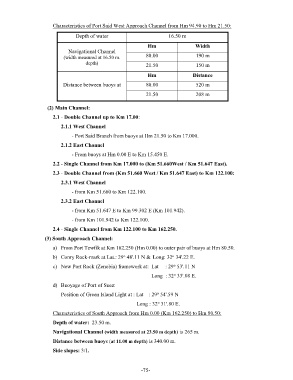
Characteristics of Port Said West Approach Channel from Hm 94.90 to Hm 21.50:

                                 Depth of water                        16.50 m
                                                               Hm                  Width
                              Navigational Channel
                            (width measured at 16.50 m.       80.00                190 m
                                     depth)                   21.50                150 m

                                                               Hm                 Distance
                           Distance between buoys at          80.00                520 m

                                                              21.50                208 m

                     (2) Main Channel:

                       2.1 - Double Channel up to Km 17.00:
                          2.1.1 West Channel

                               - Port Said Branch from buoys at Hm 21.50 to Km 17.000.
                          2.1.2 East Channel

                               - From buoys at Hm 0.00 E to Km 15.450 E.
                       2.2 - Single Channel from Km 17.000 to (Km 51.660West / Km 51.647 East).
                       2.3 - Double Channel from (Km 51.660 West / Km 51.647 East) to Km 122.100:

                          2.3.1 West Channel
                               - from Km 51.660 to Km 122.100.

                          2.3.2 East Channel
                               - from Km 51.647 E to Km 99.302 E (Km 101.942).
                               - from Km 101.942 to Km 122.100.

                       2.4 - Single Channel from Km 122.100 to Km 162.250.
                    (3) South Approach Channel:

                       a)  From Port Tewfik at Km 162.250 (Hm 0.00) to outer pair of buoys at Hm 80.50.
                                                     o
                                                                         o
                       b)  Conry Rock-mark at Lat.: 29  48'.11 N &  Long: 32  34'.22 E.
                                                                          o
                       c)  New Port Rock (Zenobia) framework at:  Lat     : 29  53'.11 N
                                                                          o
                                                                                            Long  : 32  33'.08 E.
                       d)  Buoyage of Port of Suez:
                                                                   o
                          Position of Green Island Light at : Lat    : 29  54'.59 N
                                                                   o
                                                                                Long : 32  31'.80 E.
                       Characteristics of South Approach from Hm 0.00 (Km 162.250) to Hm 80.50:
                       Depth of water:  23.50 m.

                       Navigational Channel (width measured at 23.50 m depth) is 265 m.
                       Distance between buoys (at 11.00 m depth) is 340.00 m.
                       Side slopes: 3/1.


                                                            - 75    -
   94   95   96   97   98   99   100   101   102   103   104